
Flight TrackAR
Description as a Tweet:
Using real flight data, we used AR technology to map out airplanes onto a globe to track their positions in realtime and even see a 3D view of where they're flying over!
Inspiration:
Recently I have been traveling by plane a lot and there have been times when planes have been late to get to the airport before I even board! So I wanted to make an app where one could visually see where flights are in the real world. I can also use this to track my family and friends when they fly so that I know they reached their destination safely.
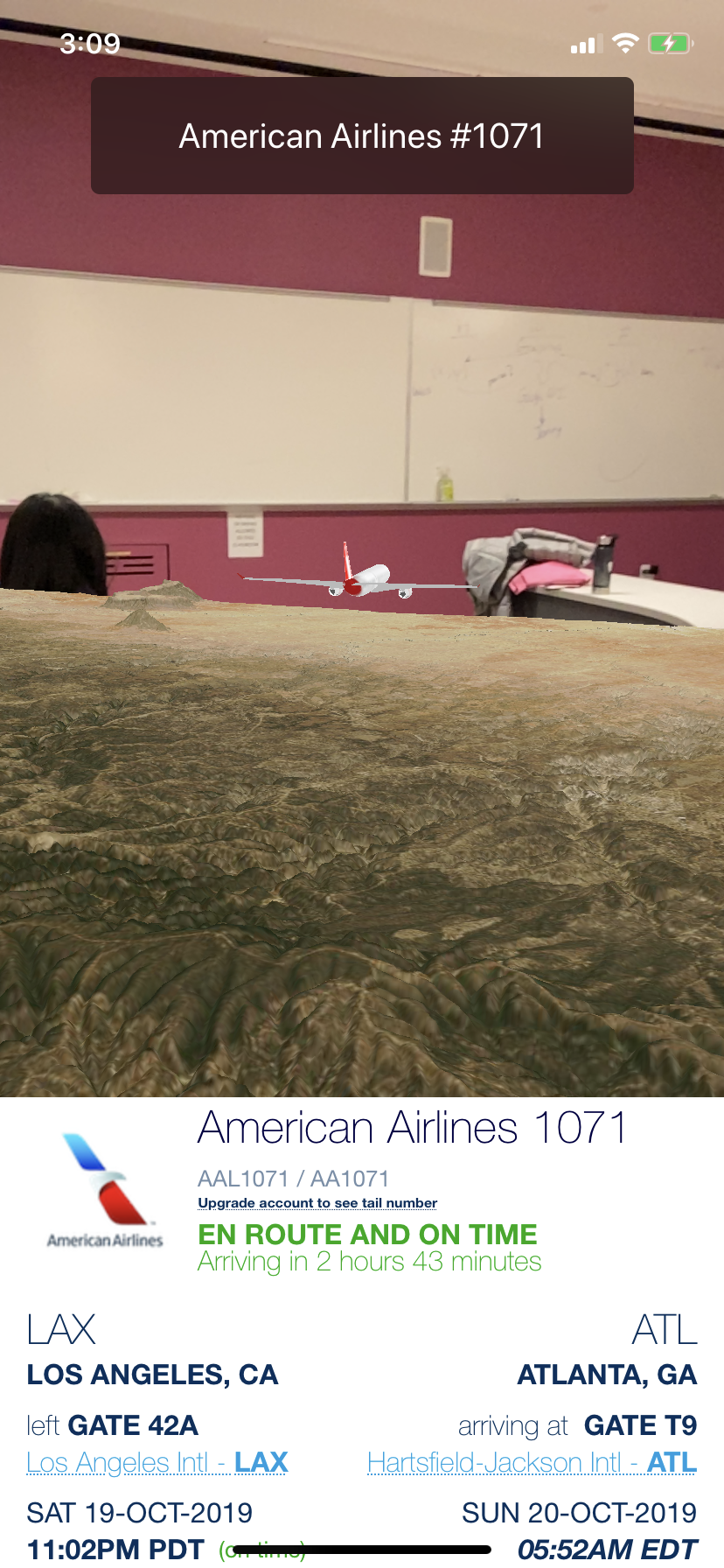
What it does:
Using Augmented Reality, this mobile app displays a 3D globe with airplanes depicting the precise real-time locations of planes that are currently flying. Through searching by airline or just by tapping a plane, flight information such as airport gates and estimated time of arrival appears as well as a 3D landscape showing the ground underneath the plane as it flies.
How we built it:
Using the Swift programming language and AR kit, we brought 3D objects into the real world. The OpenSky network's REST API was used to gather flight data and flightaware.com was used to gather airport information. MapBox's iOS SDK was used to help generate 3D terrains that match the real world.
Technologies we used:
- Swift
- Objective C
- Misc
Challenges we ran into:
The biggest challenge was placing the 3D airplanes on the 3D earth model based on latitude and longitude lines of the real airplanes. It took some pretty advanced math and reasoning to translate latitude and longitude lines to 3D coordinates on a scaled down globe. There also was the challenge of MapBox's SDK having memory and threading issues which even still sometimes causes the app crash.
Accomplishments we're proud of:
We're proud of figuring out the math required to translate the spherical coordinates of earth to cartesian coordinates of a 3D spherical yet not spherical plane.
What we've learned:
We learned how to properly use REST APIs as well as ARKit and how to convert spherical coordinates to cartesian coordinates.
What's next:
Possibly expand the amount of things it tracks such as adding trains, busses, and maybe even taxis.
Built with:
We built it with Swift, Objective-C, Xcode, and ARKit along with MapBox, OpenSky's REST API, and flightaware.com.
Prizes we're going for:
- Best AR/VR Hack
- Best Mobile App
- Best Documentation
- Best STEM Hack